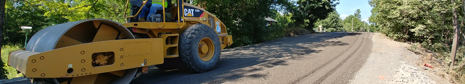


Road Closures and Construction
Road construction season is underway. See the Municipal 511 map below for real-time updates or the list of projects below for road work planned this season. Please note projects may be delayed due to unforeseen circumstances, such as weather and supply chain issues. The Township asks that drivers plan their routes accordingly and obey all signs and traffic controls in work zones to ensure the safety of local workers.
You can also follow updates on significant road projects at engagefrontenac.ca. If you have any questions, contact us at 613-376-3027 or by email pwsupport@southfrontenac.net. Some projects have been funded in part by the Canada Community-Building Fund.
Key Links
Road Construction Projects
| Bedford Road |
|
Reconstruction of a 3.6 km section of Bedford Road from Desert Lake Road to 1.0 km North of Salmon Lake Road. Construction to include full depth reclamation, placement of granular A materials, culverts, guiderail renewals and double surface treatment (chip seal). Project will also include roadside drainage improvements.
Traffic will be reduced to a single lane for the duration of the project. Traffic construction signs will be installed. Drivers and pedestrians are required to obey all construction signs and expect delays.
|
| Bellrock Road Micro-Surfacing |
|
Pavement preservation with micro-surfacing treatment will extend from 5501 Bellrock Road to Front Street (approximately 5.4 km).
Traffic will be reduced to a single lane and traffic signs will be installed. Drivers and pedestrians are required to obey all construction signs and expect delays.
|
| Bracken Culvert |
|
The Bracken Culvert is located on Yarker Road approximately 0.5 km west of Wilton Road. The culvert is a 4.4 m wide by 2.9 m high CSP arch culvert approximately 29 m in length. Records indicate the arch structure was installed in 1966 and is in need of replacement.
There will be a brief two day road closure. Traffic will be reduced to a single lane for the duration of the project. Road detour signs and traffic construction signs will be installed in advance of the project.
|
| Devil Lake Road |
|
Reconstruction of a 6.6 km section of Devil Lake Road from Centreville Road to West Devil Lake Lane. Construction to include extensive earth and rock ditching, rock cut removals (roadside hazards), localized widenings and regravelling with 100mm of surface gravel.
Traffic will be reduced to a single lane for the duration of the project. Traffic construction signs will be installed. Drivers and pedestrians are required to obey all construction signs and expect delays. |
| Greenfield Road |
|
Reconstruction of a 0.7 km section of Greenfield Road from 0.7 km west of Perth Road to west end. Construction to include full depth reclamation, placement of granular A materials, culvert renewals, and double surface treatment (chip seal). Project to also include roadside drainage improvements.
Traffic will be reduced to a single lane for the duration of the project. Traffic construction signs will be installed. Drivers and pedestrians are required to obey all construction signs and expect delays.
|
| Kerr Road |
|
Reconstruction of a 0.6 km section of Kerr Road from Petworth Road to north end of road. Construction to include full depth reclamation, placement of granular A materials, culvert renewals, and double surface treatment (chip seal). Project to also include roadside drainage improvements.
Traffic will be reduced to a single lane for the duration of the project. Traffic construction signs will be installed. Drivers and pedestrians are required to obey all construction signs and expect delays. |
| Ormsbee Road |
|
Reconstruction of a 2.65 km section of Ormsbee Road from Milburn Road to east end. Construction to include full depth reclamation, placement of granular A materials, culvert renewals and double surface treatment (chip seal). Project will also include roadside drainage improvements.
Traffic will be reduced to a single lane for the duration of the project. Traffic construction signs will be installed. Drivers and pedestrians are required to obey all construction signs and expect delays.
|
| Orser Road |
|
Orser Road is a boundary road with the City of Kingston. The City of Kingston will be overseeing the reconstruction of 2.4 kms of Orser Road from Stage Coach Road to the west Township boundary limit, and from the boundary limit to Road 38. Construction will include full depth reclamation, placement of granular A materials and a double surface treatment (chip seal). It will also include minor drainage improvements and culvert replacements.
Traffic will be reduced to a single lane for the duration of the project. Traffic construction signs will be installed. Drivers and pedestrians are required to obey all construction signs and expect delays.
|
| Spooner Road |
|
Spooner Road is a boundary road with the City of Kingston. The City of Kingston will be overseeing the reconstruction of 450m of Spooner Road from Perth Road to Leeman Road. Construction will include full depth reclamation, placement of granular A materials and a double surface treatment (chip seal). It will also include minor drainage improvements and culvert replacement. Work will also take place on Spooner Road from Perth Road to the east end, which is approximately 580m of road. This work will include road preparation for a single surface treatment (chip seal).
Traffic will be reduced to a single lane for the duration of the project. Traffic construction signs will be installed. Drivers and pedestrians are required to obey all construction signs and expect delays.
|
| Surface Treatment of Various Roads |
|
Work will begin on the rehabilitation of approximately 22 kms of surface treated roadways with localized repairs and application of a final Low Class Bituminous (LCB) single surface treatment (chip seal).
Traffic will be reduced to a single lane and traffic signs will be installed. Drivers and pedestrians are required to obey all construction signs and expect delays. Project Road List:
|
| Sydenham Lake Bridge and Dam Rehabilitation Work |
|
Rehabilitation work is being done on Sydenham Lake bridge and dam located on Sydenham Lake 170 metres northwest of the intersection of Wheatley Street near Foodland and Home Hardware. The bridge and dam was constructed around 1978 and needs rehabilitation to extend its life. The Township will be partnering with the Cataraqui Region Conservation Authority (the dam operator) on this project.
The road and sidewalk will be accessible at all times with occasional single-lane vehicle traffic. Expect traffic delays. To stay on top of updates on this project, see the project page on engagefrontenac.ca.
|
Tom Watson Road |
|
Reconstruction of a 0.6 km section of Tow Watson Road from to west end of road. Construction to include full depth reclamation, placement of granular A materials, culvert renewals, and double surface treatment (chip seal). Project to also include roadside drainage improvements.
Traffic will be reduced to a single lane for the duration of the project. Traffic construction signs will be installed. Drivers and pedestrians are required to obey all construction signs and expect delays. |
New load restrictions in effect starting mid-May 2024 — Brass Point Swing and Fixed Bridges |
|
Parks Canada has advised that the load rating for vehicles on two bridges – Brass Point Swing and Brass Point Fixed – are being reduced from 15 tonnes to 10 tonnes effective mid-May, 2024. These bridges are located on Burnt Hills Road and connect the Township of South Frontenac with the City of Kingston. Parks Canada recently engaged bridge consultants who assessed both bridges, recommending a full replacement of the timber swing bridge and significant rehabilitation work for the fixed bridge. Originally constructed in the 1880s, Parks Canada conducted repairs on both in the fall of 2023 to extend the operational life of the bridges. These load restrictions will help to further extend the operational life of the bridges while designs for their replacement and rehabilitation are developed. The permanent load rating signs will be updated from 15 tonnes to 10 tonnes by mid-May 2024. Parks Canada thanks the public for your attention to this important infrastructure matter. For questions or concerns regarding this Notice, please contact us at rideau@pc.gc.ca and include “Brass Point Swing and Fixed Bridge” in the subject heading. For more information about the Rideau Canal, visit https://parks.canada.ca/rideau, or follow us on social media @RideauCanalNHS. |


Road Closures
| Long Swamp Road Bridge |
|
On September 18, 2020 at 1:00 pm, the Township closed the Long Swamp Rd Bridge until further notice. This closure is the result of safety concerns surrounding Long Swamp Rd Bridge. Township Staff is in the process of undertaking a structural assessment of the bridge to determine what, if any, remedial work is required. Due to the bridge closure, the Township closed Long Swamp Rd from Bellrock Rd to just south of the Long Swamp Bridge. This closure will not affect access to homes in the area, which can continue to be accessed by Long Swamp Road from the South via German Rd or Huffman Rd. Access to Bellrock Rd can be obtained via Road 38 in Verona. For more information, please contact our Public Services Department at 613-376-3027. |

Temporary Road Closure Request
If your organization is planning a special event that requires the temporary closure of a road or a portion thereof, please complete the Temporary Road Closure Request form and submit it the Manager of Operations & Fleet for review. If you have any questions about this process, contact our Public Services Department at (613) 376-3027.
![]() Contact Us
Contact Us